
Maps of Rivers of India: Explore the complex systems and varied topography that are portrayed on India’s river maps. Explore the many geographic patterns and discover the pillars that support the country’s ecology.
India is a country renowned for its varied topography and rich cultural legacy. Its vast river network winds through the country. These rivers impact ecosystems, economy, and cultures all throughout the subcontinent; they are more than just bodies of water. This article delves into the detailed maps of India’s rivers, examining their paths, importance, and narratives.
Exploring the Varied Maps of Rivers of India
Maps of Rivers of India: A network of rivers crisscrosses India, a country renowned for its varied topography and rich cultural legacy. These rivers have been crucial in forming the nation’s history, economy, and ecosystems.
For a variety of reasons, including navigation and water resource management, an understanding of the topography and flow of these rivers is crucial. We explore the finer points of maps that show India’s rivers in this article, offering a thorough manual to facilitate research and discovery.
Importance of Rivers in India:
- In India, rivers are very important from a cultural and economic standpoint. They have supported civilizations for millennia and are revered as gods.
- India’s rivers are vital to the country’s agricultural sector since they sustain livelihoods and provide irrigation for large areas of land.
- Because many large cities are situated along their banks, which promote trade and commerce, they are essential for transportation.
- In addition, rivers provide hydroelectric power, which makes a substantial contribution to meeting India’s energy needs.
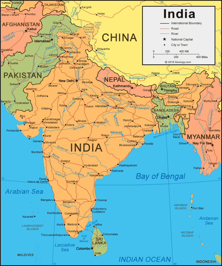
Overview of Major Rivers of India
The Ganges: Known as India’s holy river, it rises from the Himalayan Gangotri Glacier and passes through a number of states before draining into the Bay of Bengal.
The Yamuna is a Ganges tributary that rises from the Yamunotri Glacier, flows through the northern plains, and joins the Ganges near Allahabad.
The Brahmaputra: Having its source in Tibet, the Brahmaputra flows across northeastern India, providing a vital irrigation system and sustaining a variety of ecosystems.
The Indus: With its source in Tibet, the river traverses northwest India and was historically important to the Indus Valley Civilization.
Southern India’s agriculture is supported by the Godavari, Krishna, and Kaveri rivers, which have their source in the Western Ghats and flow eastward into the Bay of Bengal.
Types of River Maps
Physical Maps: The geography surrounding rivers, as well as their routes and tributaries, are shown on these maps.
Political Maps: Political maps place state borders and administrative divisions over the rivers to contextualise their importance within the framework of the nation’s government.
Hydrological maps: These maps help with water resource management and conservation efforts by providing information on the flow patterns, discharge rates, and water quality of rivers.
Sources of River Maps
Government Agencies: Organisations that create official river maps include the Survey of India and the Central Water Commission. These maps are frequently offered in print and digital formats.
Online Platforms: Users can explore Indian rivers using interactive maps that provide extra layers of information including historical data, biological hotspots, and socioeconomic indicators. These maps are available on websites and applications.
Research Organisations: To further scientific knowledge and inform policy decisions, academics and research organisations carry out studies and produce specialised maps that highlight particular features of river systems.
Utilization of River Maps
- River maps are crucial for navigation because they direct boats, ferries, and ships throughout the rivers, guaranteeing secure and effective transit.
- Flood Management: In order to regulate flooding and lessen the effects of natural disasters, it is essential to comprehend the geographical distribution of rivers and their floodplains.
- Environmental Conservation: To protect biodiversity and ecosystem services, river maps help identify environmentally sensitive areas and direct conservation efforts and sustainable development strategies.
- Planning and Development: To balance economic expansion with environmental preservation, river maps are used by urban planners and policymakers to guide infrastructure projects including bridges, dams, and riverfront developments.
FAQs (Frequently Asked Questions)
Q. How many major rivers flow through India?
A. India is traversed by several major rivers, including the Ganges, Brahmaputra, Indus, Godavari, Krishna, and Narmada, among others.
Q. What is the significance of Indian rivers?
A. Indian rivers are of immense significance, serving as a source of water for drinking, agriculture, industry, and transportation. They also hold cultural, spiritual, and ecological importance.
Q. Are Indian rivers facing any challenges?
A. Yes, Indian rivers face various challenges, including pollution, deforestation, over-extraction of water, and climate change impacts, threatening their health and sustainability.
Q. What are some conservation efforts for Indian rivers?
A. Conservation efforts for Indian rivers include pollution control measures, afforestation programs, river rejuvenation projects, and policy interventions aimed at sustainable management.
Q. How do rivers influence Indian civilization?
A. Rivers have profoundly influenced Indian civilization, shaping settlement patterns, agriculture, trade, and cultural practices. Ancient civilizations like the Indus Valley Civilization flourished along riverbanks.
Q. What is the future outlook for Indian rivers?
A. The future of Indian rivers depends on concerted efforts in conservation, sustainable management, and policy reforms to address challenges like pollution, climate change, and over-exploitation.
Conclusion
Maps of Rivers of India: The maps of rivers of India depict more than just geographical features; they tell stories of civilizations, ecosystems, and human endeavor. As custodians of these lifelines, it is our responsibility to ensure their preservation and sustainable management for the well-being of present and future generations. Maps of Rivers of India